Ukraine - Road Traffic Data

An in-depth dataset providing insights into traffic conditions, congestion levels, and road safety across Ukraine, from bustling metropolitan areas to serene countryside roads.

Vital Traffic Insights across the Ukraine

Delve into detailed metrics and analyses, uncovering the nuances of traffic flow, congestion hotspots, and speed trends essential for informed transportation planning and management across the Ukraine.

N/A

Total Number of records
Sign Up for Free

169,694 kilometerd

Total Length of Ukraine Roads (Kms)
Sign Up for Free

Столичне шосе - 86.4km/h

Fastest Road by Median Speed
Sign Up for Free

T-10-27 - 28.2km/h

Slowest Road by Median Speed
Sign Up for Free

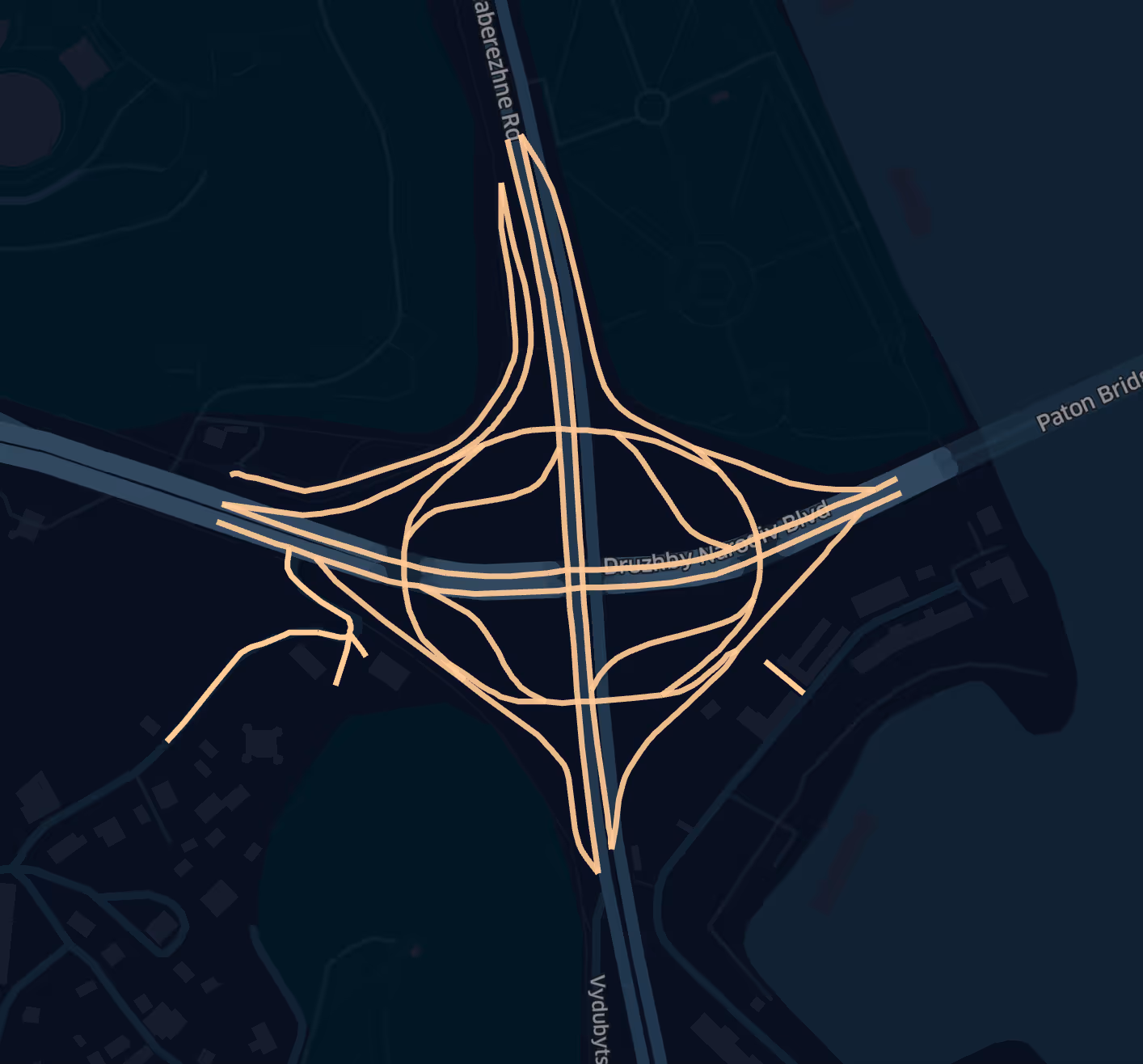
Snapshot of Ukraine Road Traffic

Leverage comprehensive traffic data to navigate and improve Ukraine’s road network, driving advancements in safety and efficiency.

Key Variables

Delve into detailed metrics and analyses, uncovering the nuances of traffic flow, congestion hotspots, and speed trends essential for informed transportation planning and management across the Ukraine.

Name
Description
Type
Sequence
The order of road segments or data points, important for mapping routes and analyzing traffic flow sequences.
Integer
Frc
A classification system for roads, determining their hierarchy and role in overall traffic mobility.
Categorical
Sample Size
The number of data points or observations collected, critical for the reliability and accuracy of traffic analysis.
Integer
Average speed
The arithmetic mean of speed data, useful for understanding overall traffic flow on a road segment.
Float
TravelTime Standard Deviation
Reflects the variability in travel time, highlighting potential delays and inconsistencies in journey durations.
Float
SpeedLimit
The maximum legally permitted speed on a road segment, crucial for safety and traffic flow analysis.
Integer
Standard Deviation speed
A measure of speed variability, indicating the consistency or fluctuation of traffic speeds.
Float
Time set
A specific time frame under consideration, important for analyzing traffic patterns at different times.
DateTime
Distance
The length of a road segment or route, key in calculating travel times and route planning.
Float
Median speed
The middle value of speed measurements, offering a representative speed of traffic under typical conditions.
Float
Street Name
The official name of a road, essential for location identification and route navigation.
String

Use Cases

How can this dataset benefit you?

Streamlining Urban Traffic Flows

Employ traffic data to reduce congestion in urban centers, enhancing the efficiency of daily commutes.

Targeted Road Safety Campaigns

Identify and address high-risk zones using data-driven insights, significantly reducing accident rates.

Infrastructure Development Prioritization

Focus infrastructure improvements where they are most needed, guided by thorough analysis of traffic patterns and congestion data.

Road Classes by Median Speed

streetName medianSpeed
T-10-27 28.2
Героїв Дніпра вулиця 31.6
Сім’ї Кульженків вулиця 34.45
Теодора Драйзера вулиця 34.9
Харківська площа 38.1
E373 40.25
Полярна вулиця 43.15
Чернігівська площа 43.8
Миропільська вулиця 48.8
Братиславська вулиця 53.8
Малинська вулиця 71.05
Дніпровське шосе 73.2
Академіка Заболотного вулиця 73.3
E95 73.85
E40 75.5
Наддніпрянське шосе 78.95
Велика Кільцева дорога 80
Брест-Литовське шосе 80.7
Одеське шосе 83.45
Столичне шосе 86.4

Analyzes speeds across highways to local roads, highlighting efficiency and congestion points, reflecting on infrastructure's impact on traffic flow.

Co-relation Matrix

Visualizes relationships between traffic volume, speed, and accidents, offering insights into patterns that can guide improvements.

Average Speed by Street Name (Top 10 Streets)

Lists streets by speed, identifying areas of high efficiency or congestion, crucial for urban planning.

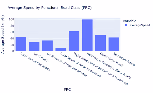
Average Speed by Functional Road Class (FRC)

Compares speeds across road types, shedding light on infrastructure performance and planning needs.

This data is provided by LocationMind but the data source is TomTom

Why xMap?

xMap empowers businesses with unparalleled location intelligence and comprehensive data analysis, guiding them towards market leadership and growth.

Close Faster

23

Times more likely to acquire customers
Sign Up for Free

Improve Sales

4.5%

Of the total revenue because of data-driven innovations
Sign Up for Free

Retain More

6

Times more likely to retain customers
Sign Up for Free

Frequently Asked Questions

Find answers to commonly asked questions about our spatial analyst platform.

What types of data are included in the Road Traffic Insights?

This dataset encompasses real-time and historical data on traffic density, accidents, road conditions, and congestion trends.

How this traffic data be useful?

It would be deal for traffic analysis, median speed, trend analysis and forecasting.

How can this road traffic dataset benefit my business or project?

Leverage this dataset for site selection, analyze road traffic on your desired business location, enhanced route planning, strategic urban development projects, and to implement proactive traffic management strategies.

Muneeb Rehman
Typically replies instantly
Muneeb Rehman
Hi there
How can i help you today?
Start Whatsapp Chat