United Kingdom - Road Traffic Data
This dataset offers an extensive overview of road traffic patterns across the United Kingdom. Sourced from reliable traffic monitoring systems, it includes detailed information on traffic densities, average speeds, and peak traffic hours in various regions. This data is vital for stakeholders in transportation planning, road safety, and urban development, providing a granular understanding of the UK's traffic dynamics.


Comprehensive United Kingdom's Traffic Data Insights
Explore key traffic metrics such as congestion levels, peak travel times, and speed patterns, crucial for informed decision-making in transportation and urban infrastructure planning across the United Kingdom.
A Glimpse into UK's Road Traffic
Explore a segment of the dataset showcasing traffic trends and statistics across the United Kingdom, essential for urban planners and transportation authorities.

Key Variables
Explore key traffic metrics such as congestion levels, peak travel times, and speed patterns, crucial for informed decision-making in transportation and urban infrastructure planning across the United Kingdom.
Use Cases
How can this dataset benefit you?
Apply traffic data for dynamic management of traffic signals and control, especially during high congestion periods in urban areas.
Utilize this dataset to plan and enhance road networks, effectively managing traffic flow and reducing congestion in rapidly growing UK cities.
Analyze data to pinpoint high-risk traffic zones and implement targeted safety measures to reduce road accidents.
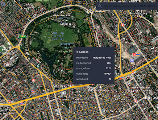
London Road Speed Data Visualization

A comprehensive visualization of road speeds across London, this insight showcases average speeds on different roads, providing a clear picture of traffic flow and velocity patterns throughout the city. This data is key for traffic management and urban planning strategies.
Median Speed by Road Class
Example of Major Roads with Median Speed
Road Traffic Data in the U.K.
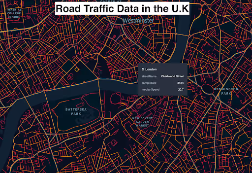
It includes detailed information on traffic volumes, congestion levels, and speed trends on various roads, from major highways to urban streets. This comprehensive insight is instrumental for national transportation planning, road safety analysis, and understanding regional traffic variations.
London Road Network with Traffic Size Relevance on Each Road
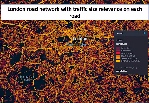
This insight provides a detailed view of London's road network, highlighting the volume of traffic on each road. It enables a clear understanding of traffic distribution across the city, identifying key high-traffic roads and potential congestion points.
Westfield Stratford City Traffic Data from Both Sides
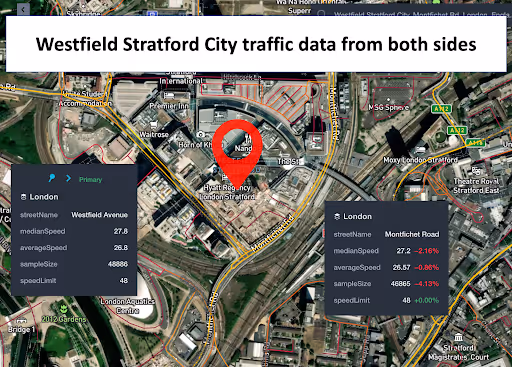
Focused on the area surrounding Westfield Stratford City, this data insight reveals traffic flow and density from both approaches to the shopping centre. It's crucial for understanding traffic patterns related to retail and leisure activities in this busy area.

London Streets with Speed More Than 50km/h
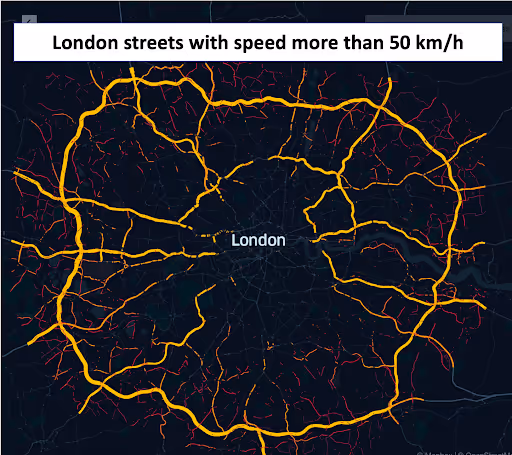
This analysis identifies streets in London where the traffic speed exceeds 50 km/h, offering insights into high-speed thoroughfares within the city. It is particularly useful for road safety assessments and urban planning.
Why xMap?
xMap empowers businesses with unparalleled location intelligence and comprehensive data analysis, guiding them towards market leadership and growth.
Frequently Asked Questions
Find answers to commonly asked questions about our spatial analyst platform.
The dataset is updated after every 3 months to reflect any new entries, closures, and shifts in the grocery market dynamics.
It would be deal for traffic analysis, median speed, trend analysis and forecasting.
Yes, our dataset is compatible with major GIS platforms, allowing for seamless integration and analysis.

